Enter your email address below to subscribe to David's Wanderings in the Wild - A Hiking Blog!


powered by Bloglet

Sunday, November 04, 2007

Fresh Air and Open Spaces - Sky Meadows State Park


There are some hikes and trips which, more than others, remind you of what hiking is all about and what drew you to this hobby in the first place. This time I have truly been on one of these hikes.

On this Sunday afternoon, I went to Sky Meadows State Park in Virginia. It was cloudy and cool, but very pleasant. This land was owned by George Washington at one time. Although I am interested in histor, that is not really the reason I visited this place.

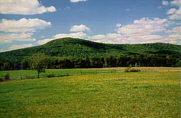
Pretty soon after I started walking, I re
ached the start of the hiking trails. It is pretty apparent to me why they had named the park as they did.


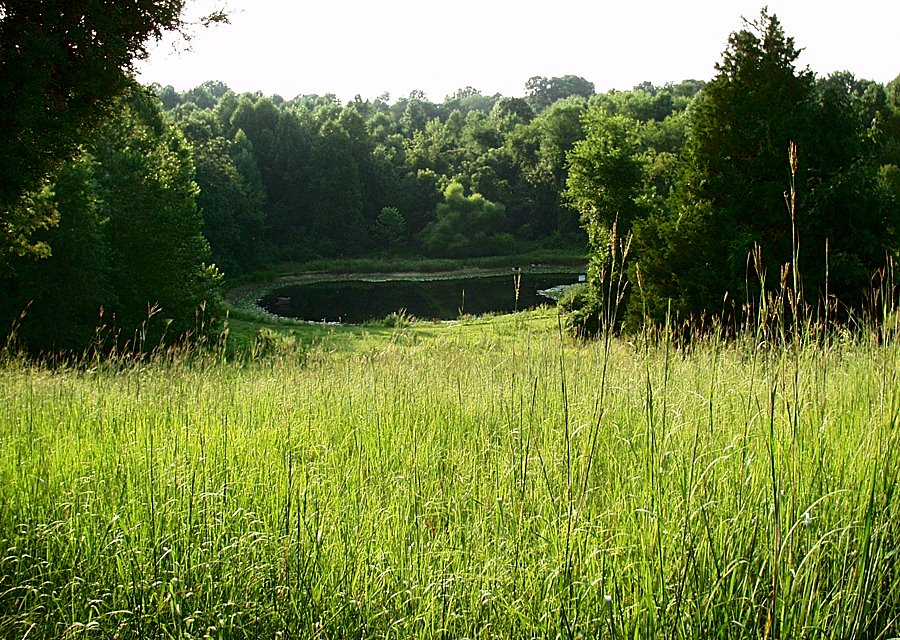
As I climbed the hill, I was passing through a meadow,
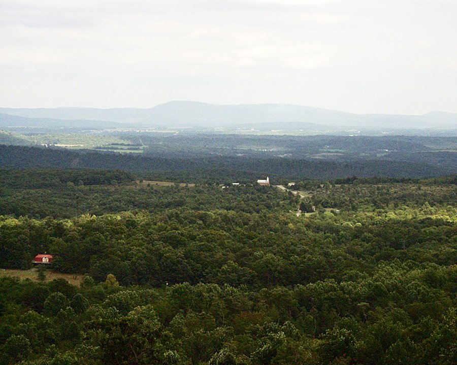
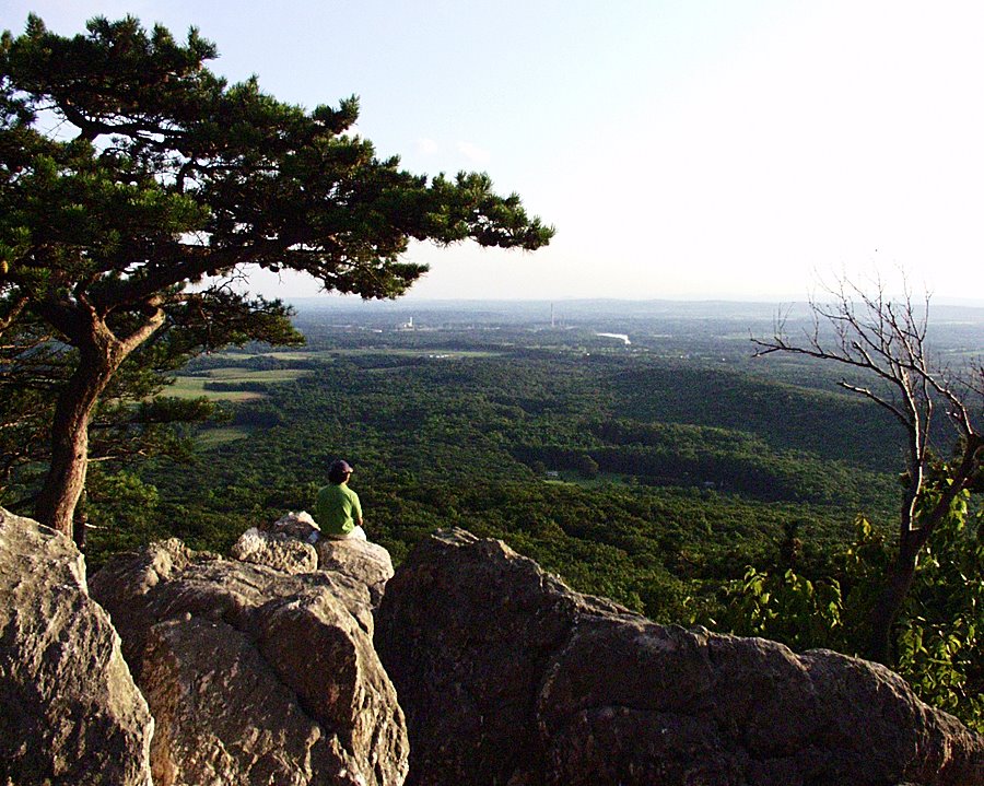
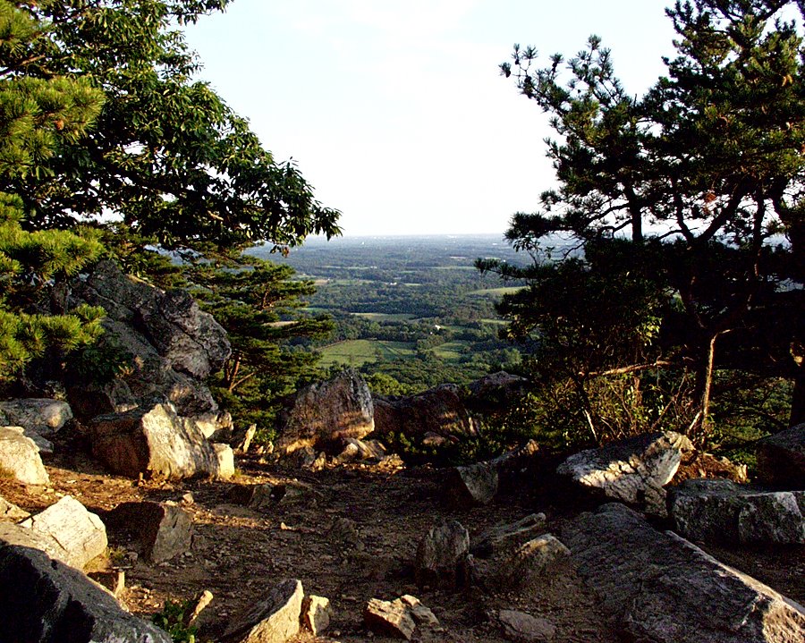
and
there was an open sky around me as well. Lots and Lots of empty space. The golden sunlight shining on the meadow contrasted with the blue and gray clouds in the sky. The sight of the buildings in the distance. Even some mountain peaks, further away still. And fall colors of yellow, red, and orange, in addition to the usual green. And just look at the space. Space and fresh air to breathe!


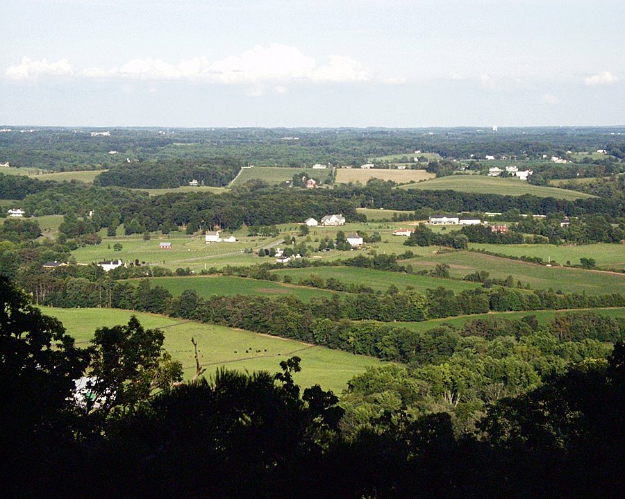
It has been a while since I have traveled to this park. Two or three years maybe. There were some people there when I arrived at about 3:30 PM. It was ok though. There was plenty of space for all of us. As time got on all the other people disappeared. It was just me, surrounded by the meadow and the sky. Within fifteen minutes of starting to walk, I felt like I was relatively high up. As I looked back down the trail, I saw several layers. First, at bottom, the meadow. Then several layers of trees and forest. Then, finally, at the back and top, the higher surrounding mountains.


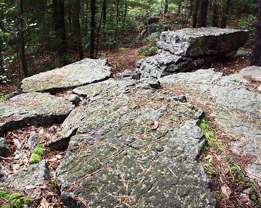
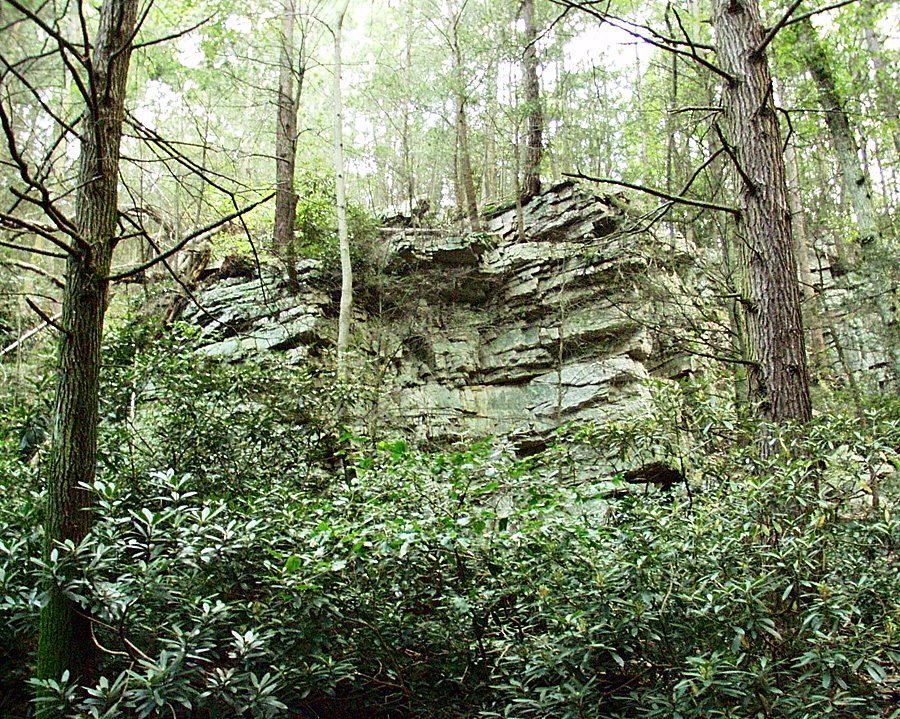
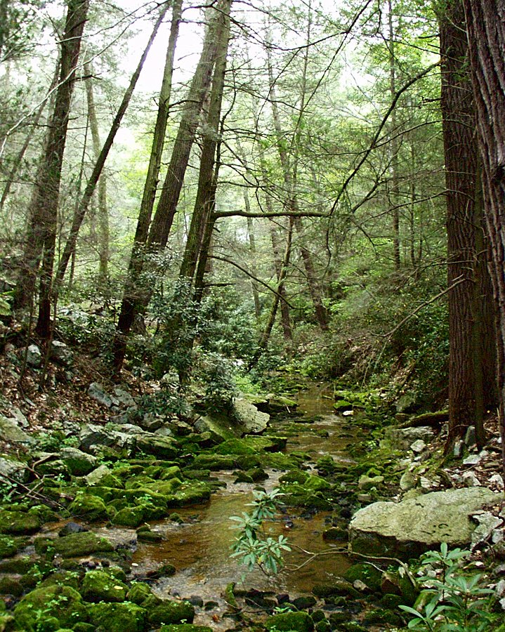
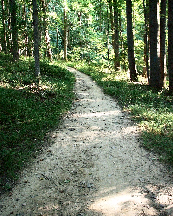
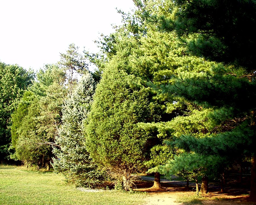
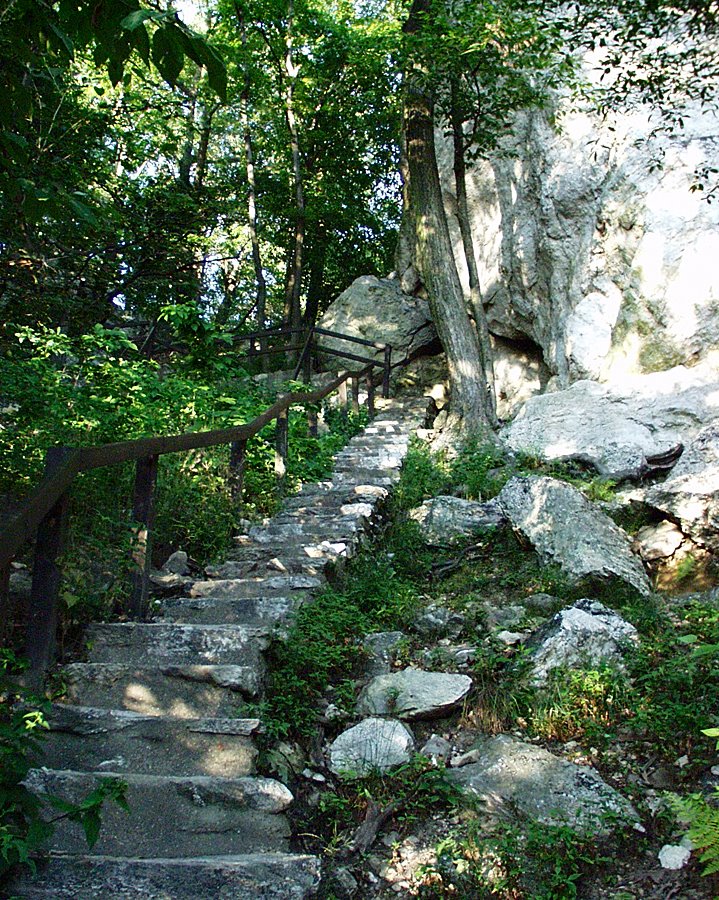
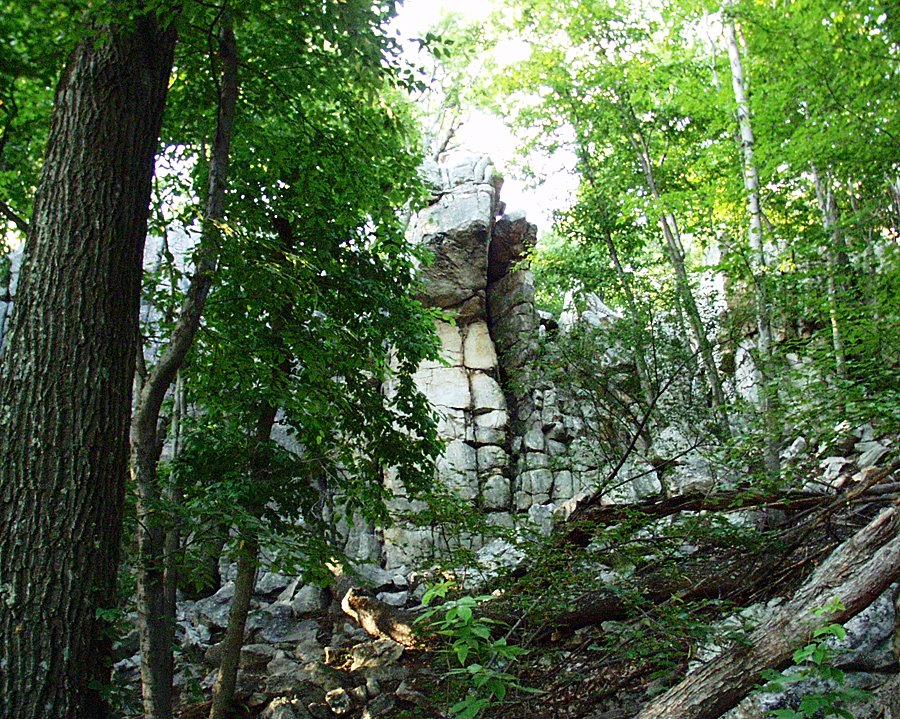
The trail led into a forest. A nice change of pace, and a welcome one for me. For me, forest means shelter, protection from the elements. I grew up on the east coast, and that means the majority of mountains here are forested. It is a wonderful change of pace for me to walk through the meadow on the way up, and it means the views are wider and clearer, but stepping back into the forest brought me to somewhere comfortable and familiar - a place that seemed secure to me. Although overdeveloped, the neighborhood I grew up in is basically forested, and that is still apparent even today. So to me, trees and forests mean shelter, protection. It is also pretty neat to see this just after walking through so much open space.

It started to get darker. Notice the shapes and appearances of the trees, and how much they can vary! The first tree stood sentinel over the edge of the meadow area, and takes on the color of the glowing sunlight. Familiar shapes of trees lit by sunlight changed into twisted shapes of silhouettes against an evening sky. Colors became less bright but more varied, especially in the sky, and the trees became mere abstractions. The sun was setting just as I came out of the forest and back into the meadow. Feeling completely refreshed, I returned to the car.

Monday, October 22, 2007

Seneca Creek Park – Close to Home

This time, I took a hiking trip very close to home. Seneca Creek State Park is very close to where I live. It is in Gaithersburg, Maryland, not far from where I used to work at my very first job in the early 1990s. Strangely enough, I had never been to this place before!

I went there with my friend Peter Philip, with whom I had gone to the Chesapeake Bay just the day before. The weather was beautiful again, and the place was almost empty because it was a weekday. This park, however, is in suburbia, in Gaithersburg, very close to all the hustle and bustle.

There are many trails in the park, but we went on one of the more interesting ones called the Lakeshore Trail, which winds around Clopper Lake for 3.7 miles. Clopper Lake was created artificially in 1976 (remember that there are no natural lakes in Maryland whatsoever). The trail hugs the edge of the lake, but meanders through the forest surrounding it, too. Since it is October, you could already see the first hints of fall colors…


Some branches of the trail, including one that we took, leads to an open field…


We thought that the lake was much more interesting, though, so we went back into the forest right by the lake…


I took a moment to meet a local resident of the lake…


After an hour or so, we wound our way around the entire lake and back to the parking lot. My parting shot is of a grove of evergreens right by the parking lot. I find trees like this to be beautiful in their simplicity and very elegant. These trees are also different from the others that surround the lake, if you compare them to the types you see in the other photos. This park was a welcome break for me.


Although we only saw Clopper Lake this time, the park was formed around Seneca Creek (surprise!) , which runs from Gaithersburg until it flows into the Potomac River. They say that Native Americans lived in this area 10,000 years ago, and that the earliest Native American dwelling is within the park boundaries. Later on, European colonists grew crops here. Maybe next time I visit, I can search for these historical structures. I enjoy history, but I prefer to explore small parts of parks, instead of taking on too much at one time.

Sunday, October 21, 2007

Nature and Nostalgia - Elk Neck State Park

First view after leaving the parking lot, Elk Neck State Park
You might notice that it has been a very long time since I posted anything to this blog. I do enjoy posting, but I only do so when I have the time, and, even more to the point, when I have something worth posting. I have not gone hiking in the past several months. However, I recently went someplace that was new to me.

I love nature (as a hiker, that should be obvious). I also enjoy reading about history. Isn’t it nice to have a little of both? That’s what this hike is. I went to Turkey Point, in Elk Neck State Park. It’s on the Chesapeake Bay, northeast of Baltimore, and not far from the border to Delaware. The closest town is North East, Maryland.

Just out of the parking lot, you see the first scenic view (above), taken from the cliffs high above the Northeast River. It’s an excellent vantagepoint, and a dramatic place to start the hike.

The next photo is of the boats on the river, and you can see the rolling hills further behind...


Here is a field that is a transition area from these opening cliff views to the heart of the park. Not such dramatic scenery, but it’s a pleasant enough place:


From here on comes the crux of the park. A 100-year old historic lighthouse, recently restored and beyond it, the Chesapeake Bay beckons…


The Chesapeake Bay features prominently in early Maryland History. The Chesapeake Bay, although very polluted now, was very important to the explorers who first discovered and explored Maryland and Virginia. It remained an important body of water for a long time, and many lighthouses like this one helped to guide the ships safely. The lighthouse is of course at a high point with a clear view of the surrounding water, and its beacon kept ships from crashing into the cliffs.

I came to this park with my friend Peter Philip. He is from Berlin, Germany, and he lived here in the Washington, DC area for a while when he was a student. That is when I met him. Since going back to Germany, he has come to visit me every now and then. When we took this trip, it was something new for both of us.

If the colors in these photos look particularly intense, then I am very pleased. They capture the essence of this experience well. Although we were already well into fall, this day was a particularly warm and comfortable one, with perfect weather. We lingered for a long time by the lighthouse and by its viewpoint over the bay. It was really relaxing and tranquil, although there was a fair number of people in the park. I felt at ease in this peaceful setting. The situation here was far better than in some of my other hiking trips of late.

After a while, we took a trail that went down from these heights to the water’s edge. Here is a photo of Peter by the water’s edge…

Here is the shoreline…


We took our time to wander back up from the shoreline through the meadow, and back to the lighthouse again. Then we went back to the car, taking it nice and slow. It has been a while since I got such rewarding views with such little effort.

I have no doubt mentioned several times that it is hard for me to get friends to go hiking with me. Peter is an exception. My friends who come from other countries seem to be really into it. Otherwise I pretty much go by myself. I really ought to find a hiking club, I guess. Then I might be motivated to go out more often, and my postings would be more frequent. What has helped is that I recently bought a new digital camera, which is both more powerful and easier to use than any other I have used. It is small and easy to carry, and it delivers great results. So now I have no excuse to leave it behind.

Thursday, June 07, 2007

Spring is here! And so are the crowds...


This place looks peaceful, doesn't it?

I am so sorry that I have not blogged in so long. I was extremely busy with work until quite recently. I have also gone hiking very infrequently, because I no longer have my own car, and have to borrow one to do this, my favorite activity, whatsoever. Have a look at the photos. Looks like a charming place, doesn’t it? Annapolis Rocks has been one of my favorite haunts for more than twenty years. A few weeks back I took a hike to get a break from work. I work in a library, which is fine, but it does leave one feeling cooped-up at times. There are not so many windows, and even less natural light, although it’s a great place to work otherwise.

I went hiking in the late afternoon, taking off at three or so on a Saturday. I did get a little bit of exercise, and I got the requisite pretty sunset view. That was good. The photos pretty much speak for themselves on that front.

The cliffs of Annapolis Rocks

However, I had trouble really enjoying it. Beautiful weather, great spot, what could go wrong? Well, lots really! I ran into more people than usual at this hiking spot. Groups were everywhere. While enjoying the view of the valley, a couple was nearby with their little child. This little girl was screaming at the top of her lungs. The place was never truly quiet. I saw some nice views, but I could not really get my mind off of work and the everyday slog that is my life.

Near the Annapolis Rocks viewpoint, I spoke to someone who is the minder for the camping area there. I guess they need him now. You can no longer camp freely there – there is a limit of campsites, and they are restricted to certain areas. You cannot light campfires there anymore, because they want to let the environment recover, and it seems that this spot has had heavy traffic in recent years.

I can remember coming here when nobody knew about this place. It’s on the Appalachian Trail, which is well known. But even if I saw other people here, there was already plenty of room for everyone. Not anymore, it seems. At least my photos don’t show that. I like to think that my photos show the part of the experience that I like and wish to remember.

I remember noticing before that they had started restricting camping at this place, but I had trouble figuring out why. Now I understand perfectly. This place really does get a lot of people, although this is the first time that I have really noticed it, and never before had that fact disturbed me in any way.

It seems that in even my relatively short time knowing the mountains here, they have started to become more crowded and less peaceful. I hope that this is a fluke!

Well, enough philosophizing and ranting, at least try to enjoy the view! That’s still my goal, and I did still manage to do that a little bit on this trip. I'll close with one more photo - of Annapolis Rocks overlooking the mountains and valley at sunset. In case you were wondering, this is what it's all about for me.

Just a brief technical note: all the photos on this post were taken with the digital camera that is built into my Samsung cell phone. It is something that I have been experimenting with. I find the quality to be decent, at least for Internet use, as long as you use it outdoors under natural light. Please let me know what you think of them!

Sincerely,

Dave

Sunday, September 10, 2006

Foray to Western Maryland

Look at this photo...this highway is called Interstate 68. This mountain pass (if you can technically call it that) is the gateway to Western Maryland, the wildest part of my native state. Last Sunday (just over a week ago now) I decided to go to a place that I had not been to in a long time. The mountain gap in the photo above is a place that I passed by on the way out to the park. This mountain is called Sideling Hill, and to build the highway through it they literally dynamited the whole mountain. Driving to Western Maryland through this highway (built in the early '90s) saves you 40 minutes to an hour on the trip each way. When you take this highway, the road goes very high up, and is a bit of a chore to drive. To the right of the area that this photo shows is an exit where you can pull off to see a museum about the highway construction, as well as get this beautiful view from on high...

Not bad for a start, huh? And this is only about halfway on the drive out to my final destination. I haven't even begun walking yet. Western Maryland is quite remote and off the beaten track. Because of this highway, it is maybe more popular than before, but before the highway it was completely unknown. As you can see it was rather cloudy. Because of this, the day was cooler than usual for summer and a bit windy, and it was already 3 PM. Quite a refreshing change from the stinking hot summer weather here near Washington, DC!!

After driving for close to three hours (and completely by myself again, as usual, I might add), I reached my goal. It is Rocky Gap State Park, which is a State Park which also has a resort attached. There are several parks in that area, but this one caught my fancy for the day. You could say that Rocky Gap is sort of a hybrid. It has a resort, complete with golf courses and a resort and conference center, with an artificial lake to boot. It also has some remote and wild nature with hardly a human being in sight.

Here is a photo of the lake. I took this from the Lakeside Loop trail which goes around the lake. In the distance you can see the mountains.

The further away you get from the resort buildings, the quieter and more remote the place becomes. Not quite quiet enough for me, though. There were still signs of human habitation almost everywhere, and I took the photos carefully to avoid showing them.

In this last photo by the lake, you can see one of the mountains a little bit more closely. It is to that area that I headed. I figured that it would be a bit quieter there, and the signs mentioned some homestead trail where some guy built a cabin to live in seclusion. So I turned in that direction, branching off from the Lakeside Trail.

The trail turned up, climbing up through the forest. This photo is the only clear view I could get, from the very top. The ridge across the way is completely forested, covered with trees.

This next photo below is of an interesting rock formation that I passed over and through as I crossed the ridge. The trail went down into a valley once I crossed these rocks.

The trail is steeper than it appears to be. I actually slipped once on my way down. Here is a view of the forest as I was walking down the slope. If you look carefully, you can see the forest leading up the slope of the mountain on the other side:


The trail then lead me into a sort of canyon that was cut through the rocks in the area. Here is a photo of the canyon wall from the bottom:


After this descent, I was at the very bottom on the other side of the mountain. At the bottom was a creek:


The water in the creek was extremely stagnant, and I could even smell it. However, this was otherwise a pretty area, and finally I was completely by myself. Somewhere nearby was the homestead that the hermit had retreated to, although I was not sure of the precise location. The legend goes that sometime in the 1800s, this man asked a woman to marry him, and when she refused, he went into seclusion into this area of the hills.

I must say that I enjoy seclusion, but only for a few hours or a day or two at a time. However, he chose a pretty beautiful place for it if the legend is true.

I continued walking up the next hill, until I reached the trail that went to that old homestead. I paused here for a break before turning back the way that I came. I had a snack of a peanut butter bar, and I made some coffee with a camping stove and a special insulated pot. It is a propane/butane stove, and I heated up some water, and added the coffee. I had a "French press" attachment for the pot designed to filter out the coffee grinds. I felt pretty refreshed after that.

I was about three-quarters of the way back when it was totally dark. The sky was dark blue, and the moon was almost full by the lake when I reached it. For that reason, I had enough light. Most people had left by that time, and the air was very cool. This is what hiking is about for me. I felt energetic (a rarity these days), and I enjoyed the beautiful, now haunting scenery. Finding the parking lot was a bit tricky, but I reached it by 9:45 PM or so.

What can I say? It was another half day well spent. I really ought to stop being so damned lazy and spend a full day out in the woods next time.

Dave

Tuesday, August 29, 2006

Serenity in Suburbia. (Believe it or not, this lake is not real!)


In my last post about my hike to Sugarloaf, I started a theme upon which I would like to expand
this time. It is perfectly possible, at least where I live, to discover nature and get some peace and quiet, practically in your own backyard, not far from your home in suburbia. I am accustomed to traveling at least an hour or more to see the mountains, and because of this I have neglected perfectly nice places near my home. Indeed, my region is heavily forested, and there are parks in Rockville, my city. I shall show you one of them today. I took two trips to one of them recently. I made the two trips on Sunday evenings, one week apart.

My hike begins in the north of Rockville, near the border to Gaithersburg, near Muncaster Mill. The Meadowside Nature Center (not shown here) describes the flora and fauna of the region. Here we are in the upper part of Rock Creek Park

The Trail starts innocently enough at the top of a hill in the middle of the forest, near the parking lot for the Meadowside Nature Center...


The trail winds its way through the forest and downhill.


There are several branches and ways that the trails wind, but there are two basic directions that you can go, which intersect at a couple of points. This creek is at the bottom of the hill, and follows the Sleepy Hollow Trail.


The first way which I will show you was from my first hike – you can go out of the forest and into a meadow area, which will get you views of the meadows and more open land areas. From this view of the creek, you turn right, and then turn left to cross the bridge in the photo below.


The trail leads you out of the forest to the meadow. This area is more open. I was able to feel the summer heat more here , but it was peaceful, especially in the late afternoon and early evening.


This next area over is next to a farm...


Further down, you see a pond...


This view is further back near the Nature Center. Next to the Nature Center is the Lathrop E. Smith Outdoor Education Center, and this forest of Evergreens is in the back part of the Smith Center. When I was a child I stayed overnight here on several occasions. It was in part due to this place that I learned to love and appreciate nature.

On my second hike to this park, I visited Lake Frank, the other major feature of this park. I went back to the creek at the bottom of the hill and crossed it at a different point this time.

The creek snakes on through...


and eventually becomes wider and opens up into Lake Frank....


The path winds its way through the forest around the lake.


By the time I saw this last view it was starting to get dark, and I found the trail that took me back to Meadowside Nature Center.

I do not show it in these photos, but Lake Frank is artificial. It is a reservoir, and there is an artificial hill with a concrete monstrosity in the water in front of it that shows this. However, I chose to ignore that, because the rest of the lake looks natural and very peaceful. I was less than ten miles from my home in suburbia, but it felt farther, and after my walk I felt better.

On this walk I met a couple from Shanghai, China, and a couple from Augsburg in Southern Germany. It was the first time in a while that I had practiced my German, but we did not have time to chat long because it was already getting dark.

Sunday, July 23, 2006

Sugarloaf Mountain


Today I sought out something easy - instant gratification. Of course I was too lazy to get going early, which is quite usual for me. I am trying to motivate myself to hike more often, and this blog is one of the ways I am trying to do this. However, it has been extremely hot in my area lately, to the point that it has even gotten dangerous. As usual, it was impossible to get anyone to go with me. To beat the heat I set out for Sugarloaf Mountain in the late afternoon. Sugarloaf Mountain is quite close to me - it's probably the closest mountain to where I live. It is a monadnock - that's a mountain that was created by erosion when the land around it was worn down by wind and rain. The photo above is the mountain from a distance, taken in the surrounding valley. That photo is not mine, it's from the website that I just linked to. My photos will show this place in more detail and up-close.

To hike this mountain, you park at the top. You can park your car on the east side or the west side, and the summit is a bit higher in between the two. I parked my car in the west side lot. I took this next photo from one of the parking lots:

I think that this view is not too bad for a beginning. From these parking lots, you are almost at the top of the mountain already - you have driven up it. Therefore, the stretch from either parking lot to the summit is relatively short. This factor, together with the mountain's relative proximity to the city, are what make the place so accessible to folks like me who cannot plan time well.

The next batch of photos are from the trail that goes from the West side up to the summit. It's true that there are rock formations (people sometimes climb them), but the staircase is far easier than navigating the rough trail that goes up from the East side. Look at the staircase and the rock formations in this section:


The next couple of shots are of rock formations on the summit. There are some pretty interesting ones here:


And here are some wide views from the summit. These photos were mostly taken in the early evening towards sunset, and I believe that these came out the best.


Unfortunately (or fortunately, depending upon how you look at it), these last few wide shots show you how close to civilisation this mountain really is. The presence of another person on the top, for example.
Since Sugarloaf Mountain is so close to the city, it is more crowded than many other mountains here. It's very much "on the beaten trail", as it were. Several groups came and went while I was up on the summit, although you see only one other person in the photos here. You can also see the smokestack in the distance, especially in the first two photos in this last series.

Having contact with other human beings does not always have to be unpleasant, though. When I reached the West parking lot again, a nice guy approached me and asked me about the digital camera I was using. We got to talking and continued until it was very dark. As it turns out, we had a couple of similar interests, and he was an immigrant originally from El Salvador named Nelson. I had been an expat in Germany and Japan myself, so we compared our experiences. I would have included a photo of him here, except that it was too dark by that time. So, Nelson, if you find this blog, please feel free to type a comment!


What does this have to do with my hike? Well, the people you meet in the mountains can be very interesting. The fresh air and relaxed setting make people more friendly and willing to chat. What I also found is that a lot of hikers come from other countries. As I think I mentioned before, most of my friends who like hiking have been from other countries, not my local friends who are just too lazy. Hiking and exploring nature can be part of international and intercultural communication. It's true that you don't want things to be too crowded on the trail, and you have to find the right balance between crowds and utter isolation. However, running into an occasional human being does not have to be a bad thing, and at Sugarloaf I have met a number of very nice and interesting people over the years. It's about quality, not quantity. And the scenery is nice to boot. As you can tell, I'm a sucker for sunsets. Not bad for getting a late start on a lazy Sunday, huh?