Sugarloaf Mountain
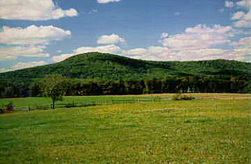
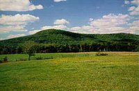 Today I sought out something easy - instant gratification. Of course I was too lazy to get going early, which is quite usual for me. I am trying to motivate myself to hike more often, and this blog is one of the ways I am trying to do this. However, it has been extremely hot in my area lately, to the point that it has even gotten dangerous. As usual, it was impossible to get anyone to go with me. To beat the heat I set out for Sugarloaf Mountain in the late afternoon. Sugarloaf Mountain is quite close to me - it's probably the closest mountain to where I live. It is a monadnock - that's a mountain that was created by erosion when the land around it was worn down by wind and rain. The photo above is the mountain from a distance, taken in the surrounding valley. That photo is not mine, it's from the website that I just linked to. My photos will show this place in more detail and up-close.To hike this mountain, you park at the top. You can park your car on the east side or the west side, and the summit is a bit higher in between the two. I parked my car in the west side lot. I took this next photo from one of the parking lots:
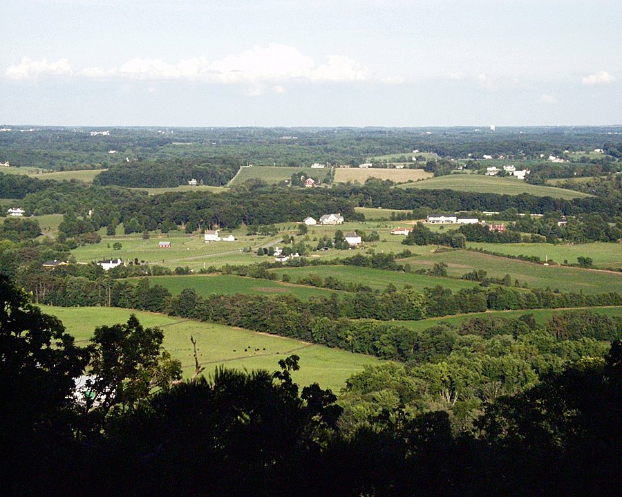
 I think that this view is not too bad for a beginning. From these parking lots, you are almost at the top of the mountain already - you have driven up it. Therefore, the stretch from either parking lot to the summit is relatively short. This factor, together with the mountain's relative proximity to the city, are what make the place so accessible to folks like me who cannot plan time well.
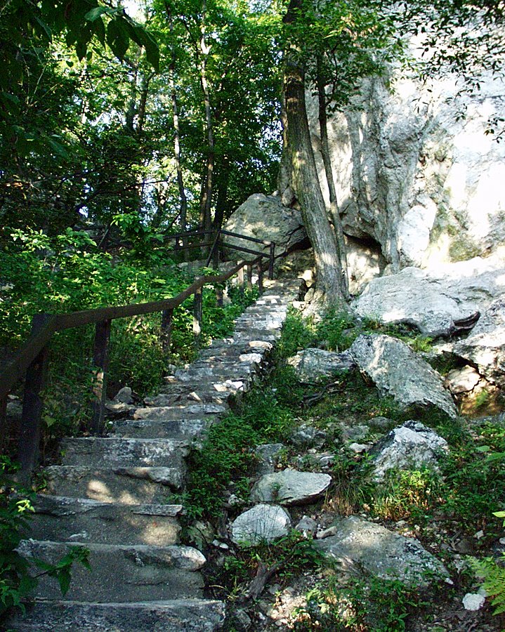
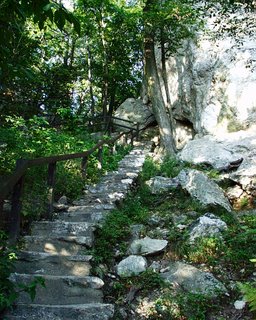
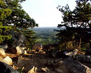
The next batch of photos are from the trail that goes from the West side up to the summit. It's true that there are rock formations (people sometimes climb them), but the staircase is far easier than navigating the rough trail that goes up from the East side. Look at the staircase and the rock formations in this section:
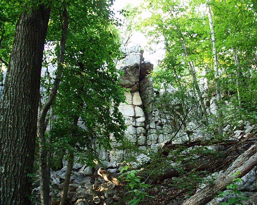
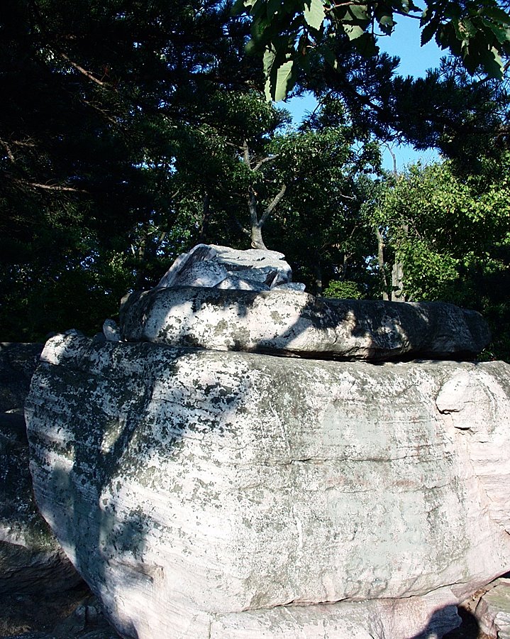
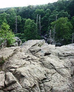
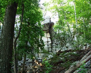 The next couple of shots are of rock formations on the summit. There are some pretty interesting ones here:
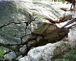
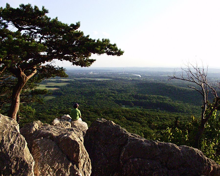
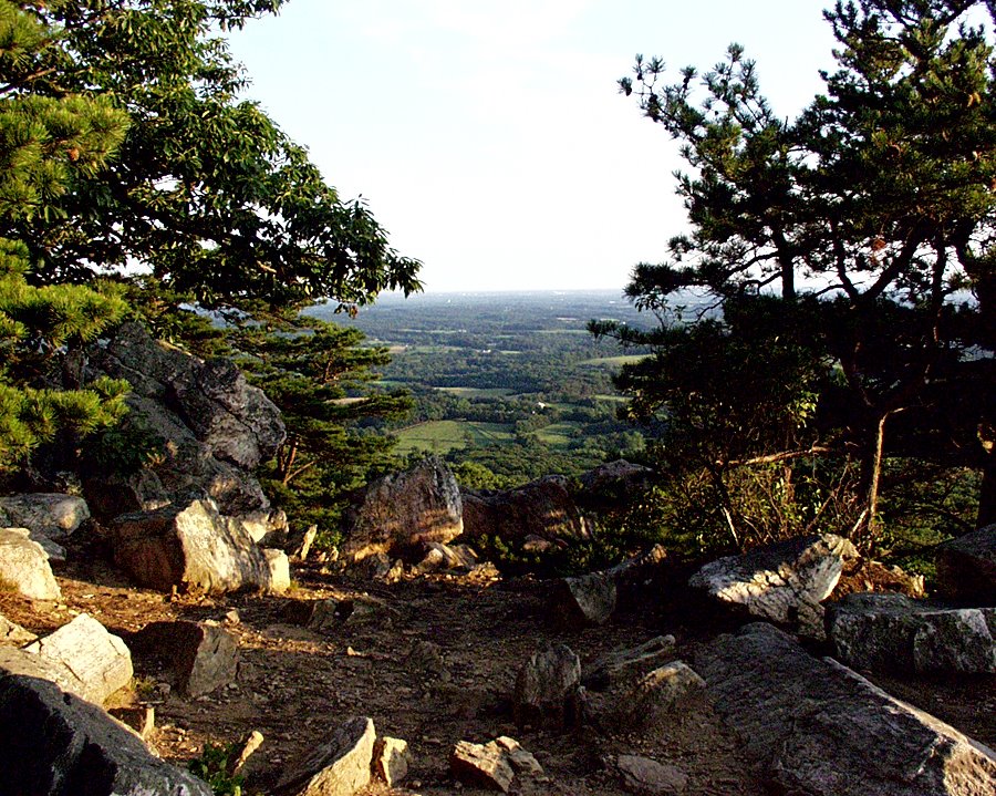
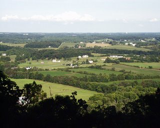
 And here are some wide views from the summit. These photos were mostly taken in the early evening towards sunset, and I believe that these came out the best.
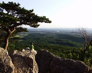
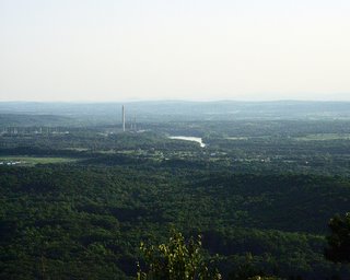
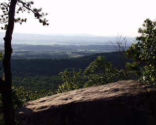
Unfortunately (or fortunately, depending upon how you look at it), these last few wide shots show you how close to civilisation this mountain really is. The presence of another person on the top, for example. Since Sugarloaf Mountain is so close to the city, it is more crowded than many other mountains here. It's very much "on the beaten trail", as it were. Several groups came and went while I was up on the summit, although you see only one other person in the photos here. You can also see the smokestack in the distance, especially in the first two photos in this last series.
Having contact with other human beings does not always have to be unpleasant, though. When I reached the West parking lot again, a nice guy approached me and asked me about the digital camera I was using. We got to talking and continued until it was very dark. As it turns out, we had a couple of similar interests, and he was an immigrant originally from El Salvador named Nelson. I had been an expat in Germany and Japan myself, so we compared our experiences. I would have included a photo of him here, except that it was too dark by that time. So, Nelson, if you find this blog, please feel free to type a comment!What does this have to do with my hike? Well, the people you meet in the mountains can be very interesting. The fresh air and relaxed setting make people more friendly and willing to chat. What I also found is that a lot of hikers come from other countries. As I think I mentioned before, most of my friends who like hiking have been from other countries, not my local friends who are just too lazy. Hiking and exploring nature can be part of international and intercultural communication. It's true that you don't want things to be too crowded on the trail, and you have to find the right balance between crowds and utter isolation. However, running into an occasional human being does not have to be a bad thing, and at Sugarloaf I have met a number of very nice and interesting people over the years. It's about quality, not quantity. And the scenery is nice to boot. As you can tell, I'm a sucker for sunsets. Not bad for getting a late start on a lazy Sunday, huh?
Shenandoah - Whiteoak Canyon
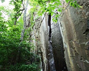
Yes, yes, I know. It's about time, right? I promised you I would post something, so here I am at last. But anyway, this photo isn't bad for an opening shot, is it? Yesterday I went to Shenandoah National Park in Virginia. Skyline Drive is the scenic road that goes through the park. To save time, I didn't enter at the North Entrance at Front Royal. Instead, I went to Luray, a bit further south, and entered at Thornton Gap using US 211, near Mile 32 of Skyline Drive. Just south past Mile 32, I drove through a tunnel, and then I stopped on the left for a scenic view just out of the tunnel (Mile 32.4, Tunnel Parking Overlook):
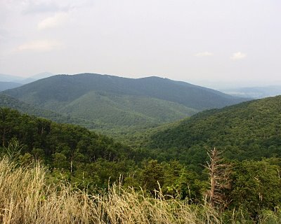 The drive up into the mountains was steep and I felt my ears pop. This is the only really broad scenic view that I took, because it was a hazy summer day, and views were not going to be the nicest anyway. For that reason, I chose a forest hike with a canyon and views of a waterfall. For that I drove about 10 miles south of the entrance and this first view, or about 16 kilometers if you use metric. I parked my car at Mile 42.6, Whiteoak Canyon Parking. This hike was an ideal choice, because I would not have to look for views a long way off that were blocked with ozone haze, and the forest and water would keep me cool. I got started hiking around 4 PM on a Sunday, which is late, but made for pleasant temperatures, even if it did mean I was a bit crammed for time.
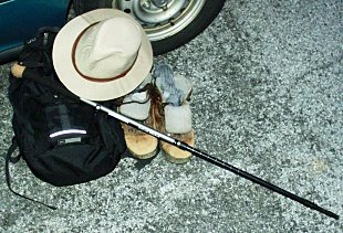
 In the parking lot, I donned my oh-so-sophisticated hiking gear (left). My daypack with honey-roasted nuts, my hat to keep out the bugs, my metal hiking staff, and worn out leather boots and cushioning socks. Just the get-up I needed to tackle the
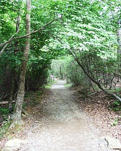 job at hand. The photo just to the right now is of the trail right near the beginning point. The guidebook I was using (Guide to Shenandoah National Park and Skyline Drive, by Henry Heatwole described this as a difficult hike. It certainly started out easy enough, and did not look difficult at all. What could be easier, more charming, more benign than this flat path throught the forest? Although perhaps a little difficult to see here, the forest had considerable damage, unfortunately. There had indeed been storms, including heavy rainstorms which caused mudslides and flooding in the area recently. You can see a fallen tree or two in the photo at right. Photo-wise and experience-wise, I tried to make the best of it, though. Fortunately, no matter what your interest, you can always have a great time in Shenandoah, even if it's hot (as it was that day), or if the trail or view is not perfect. That's how wonderful a place it is.
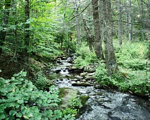
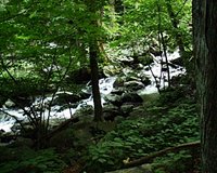
One very satisfying aspect of seeing a waterfall is that you can sometimes see its source and watch it develop as you go down the trail. That was very much the case here. Now look at these two photographs. This is when things started to get interesting. The water here started as a stream and a trickle, and at the photo at right became a small creek. A very nice setting, I think. The creek gradually got wider, and at left you can see one bridge that I used to cross it. The trail crossed the creek several time using bridges of this type, as it wound
  down into a canyon. At the start, though, you would never have known that there even was a canyon. The trail did gradually gets steeper, and you did eventually get the sense that you were going downhill. As I made my way down, I knew that it was the latter part of the afternoon, and that every foot I went vertically down, I would have to go back up again in order to return to the parking lot.

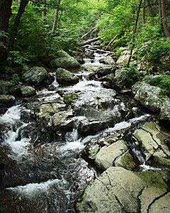
 Now in these next two photos, you can see this creek getting steeper and faster. I started to have to watch each step I took more. The way started to get a bit difficult, but I had forgotten the mundane cares of a working life. I had already forgotten about the nervousness of starting a new job, about everyday worries, etc. I had seen some people near the start of the trail, but now there was nobody else on the trail. I was completely immersed in nature. Most of the people I had met were going the other way, towards their cars. That's how I like it. I go to the places when they are a little more empty. The photos are also a little better in the evening because the sun is low in the sky, and I don't have to fight any crowds to get the nice views.
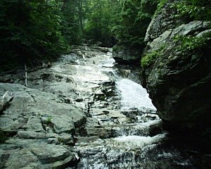
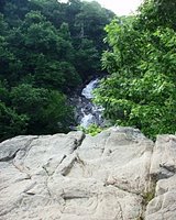
 Now in the photo at left is the top of the canyon. On the other side of it is a forest - here I was just seeing over the rocks. In the next photo on the right below you can start to see the waterfall. This view is way too remote, though. I wanted to see it up-close and personal. However, this put the waterfall into context for me, and it was quite easy to see that it was part of a canyon. From the stream at the start, you could see how the waterfall started, and now you could see what it had cut into.
I turned back to the trail and descended into the canyon. This part of the trail got steeper and was tricky, but I have certainly hiked in far worse conditions before. It could be that Heatwole exagerrated the difficulty slightly, but descending into the canyon, I did begin to feel it in my knees a little.
 Look at the canyon walls here, at the photo on the right! This photo begins to give you a sense of it.As the trail got steeper and the footing ever less secure, I realized that I had to turn back soon. As is my custom, I wanted to end my hike with an interesting view. The thing that I had been building up to and waiting for. Usually that's the view of the mountains and the valley at sunset, but today it was slightly different. Anyway, now I had finally reached my goal, the bottom of the uppermost falls. There are several more falls further down, but this was enough for one day. This sight made for a good ending, and it was already getting late.

 On the way back, I hurried to get back to the car before sunset. I could have sworn that I saw a bear on the way, but I couldn't be sure because it was too far away from me to see well. I saw several deer as well. I hurried because I wanted to keep a healthy distance from that bear. I got back to the car at 9 PM, right around sunset.Please feel free to leave comments and tell me what you think of this blog and my adventures. Usually I go to these places alone (as I mentioned in my first post, my friends are kind of lazy as far as hiking is concerned). I'm happy to plug into the hiking and blogging communities and compare notes and swap stories, and links and comments to my blog are more than welcome. I tend to take a lot of photos, so it takes a lot of time to prepare them. My next post will have more of the standard mountain sunset stuff. Anyway, happy trails and I'll see you next time!
Sincerely,
Dave
Why no hikes yet? Or Rats! Foiled Again!
I must apologize for the fact that I have not posted any entries about actual hikes yet. Lately I have not had much time. I promise to go hiking at least once in the next week, hopefully next Sunday. Unfortunately, the weather has been horrible lately. It has rained heavily in my area from last Sunday through Wednesday, to the point that some areas were flooded. My own neighborhood is safe, but of course hiking is out of the question until we get a break in the weather. I tried again to go today, and another thunderstorm put a quick end to that. So instead of hiking, I have been reading about hiking a little, looking at several books that I have on the subject.
Here are the books I have been reading through:
- Walking Softly in the Wilderness, by John Hart.
- Guide to Shenandoah National Park, by Henry Heatwole.
- 100 Easy Hikes Washington, DC, Northern Virginia, Maryland, Delaware, by Barbara A. Noe.
- 75 Hikes in Virginia's Shenandoah National Park, by Russ Manning.
These books are practical guidebooks. Walking Softly in the Wilderness was my textbook when I took the hiking and camping class at Montgomery College back in 1992, and tells you everything you have to know about equipment and safety for hiking and camping. Since I had lost the edition I had when I took the class, I just bought the latest, most up-to-date version today. Heatwole's Guide to Shenandoah National Park is the bible for hiking in Shenandoah, with lots of maps and diagrams. The other two are decent guidebooks to Shenandoah and other parts of my region, as the titles suggest.
For a real change of pace, I picked up Weird Hikes: A Collection of Bizarre, Funny, and Absolutely True Hiking Stories, by Art Bernstein. The title speaks for itself, and I am just starting to read it. So far, it's amusing reading. Another narrative, this time about doing a thru-hike on the entire Appalachian Trail, with brilliant photos, is Appalachian Adventure From Georgia to Maine - A Spectacular Journey on the Great American Trail. This book was written by a group of Newspaper reporters.
Isn't it such a drag to be forced to just read about hiking, instead of being able to do it? I would say so, but when it's raining and flooding, there's little else you can do. I also had to charge my brand new camera batteries, while sitting out the thunderstorm. This reading will at least help me to prepare for the real thing.
That's all for now. I'll keep you posted when I finally get out of the house!
 I think that this view is not too bad for a beginning. From these parking lots, you are almost at the top of the mountain already - you have driven up it. Therefore, the stretch from either parking lot to the summit is relatively short. This factor, together with the mountain's relative proximity to the city, are what make the place so accessible to folks like me who cannot plan time well.